Is the Arabat Fortress Working Again?
Arabat Spit—a new life for the resort zone.
Ivan Klepyk. Newspaper "Krymska Svitlytsia", 2019, Issue No. 47-48
The Arabat Spit, which looks like a tiny thin bone on the map of Ukraine, is not only a unique natural phenomenon. It has long been a carrier of certain associations and stereotypes. For example, a washboard road and deserted beaches are two very vivid and most common characteristics of these places. That is exactly how it is shown in the film "Such Beautiful People," filmed in 2013.
Although after 2014, the northern part of the Arabat Spit, which is part of Kherson Oblast, ceased to be deserted. The north of Arabat is that tiny piece of the peninsula where one can go without interacting with Russian border guards. That is exactly why Ukrainians willingly go there to vacation.
However, the occupied part of the spit is completely empty.
The Arabat Spit is another example of empty land lying under the feet of civilization. Crimea has always surprised with its boundless space and the inability to manage that space.
This spit-peninsula, 112 km long, appeared relatively recently. The formation of the Arabat Spit began in 1100–1200 AD as a result of the shallowing of Lake Syvash and the Sea of Azov, since it was here that salt began to be extracted by evaporation. (They say the Chumaks traveled for salt to the Arabat Spit). The spit became fully dry land only in the 17th century.
Later, the Arabat Spit turned into a place of strategic importance, since one could also get to Crimea through it.
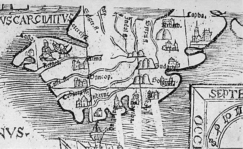
According to one version, the spit got its name precisely from the fortress – rabat (military post). Over time, this word began to be pronounced as Arabat.
When exactly the fortress was built is unknown. Instead, we know that the Arabat fort was rebuilt many times for different needs and depending on the situation.
The first mention of the fortress is found in 1651 in the book "Description of Ukraine" by Guillaume de Beauplan – a French military engineer and famous cartographer. Beauplan wrote: "Arabat, or Orbotec, is a stone castle with a tower, located on the isthmus of the peninsula that is enclosed between the Liman Sea [la mer de Limen] and Thin Water [Tineka Woda]. This neck is no wider than one-eighth of a league, where a palisade stretches from one sea to another. Our Cossacks call the peninsula Kosa [Spit], because it has the appearance of a spit. In this place the Khan keeps his herd, in which, they say, there are up to 70 thousand horses.
Tinkawoda is a strait between the mainland and the Spit. It is only 200 paces wide, and in calm weather, it can be crossed on horseback. The Cossacks cross it with their camp when they go to steal horses from the Khan's herd, of which we shall write shortly." However, on the map of Southern Sarmatia created by Bernard Wapowski in 1526, the word Arabat is already present. This barely noticeable mark near the mouth of the Tsuriuk-Su River indicates that the fortress already existed during the Turkish conquest. Evliya Çelebi, a Turkish writer who traveled through Crimea in 1666–1667, also writes about the fact that the fortress was built long before 1651.
In his "Book of Travels," he tells a legend about the reason for building the defensive fort. Çelebi writes: "This large and strong tower of round shape stands on the cape of the Crimean land, projecting into the Sea of Azov, in a flat place, among meadows and grass. It was built by our master Mehmed Giray Khan... And the reason for its construction is this: several Crimean Cossacks from among the Cossack slaves swam across the Azov strait to the side of the Kheitat steppe and reached the Kalmyk Tatars. 'The Sea of Azov near this Arabat cape turned out to be shallow,' they said, 'we escaped and ran to you.
Now we will return there, strike the Crimean island, take many goods from the Tatars, and free many of our people from slavery.' Having found a weak spot in the peninsula's defense system, the Cossacks indeed tempted many Kalmyks with promises of rich booty in Crimea, and crossed the Sea of Azov to the Arabat Spit. Of course, this was unexpected, and the first Crimean settlements were unable to repel the Cossacks and Kalmyks."
At that time, the nearest garrison was located in Perekop, in the fortress of Or-Qapu. A detachment marched from there, which eventually "passed the Kalmyks through the teeth of Mohammedan swords." And the Cossacks were executed.
That is, according to Çelebi's testimony, the fortress was built during the reign of Khan Mehmed II Giray (1577–1584).
And in the 17th century, during the era of Khan Mehmed IV Giray, it was rebuilt for the needs of the time – to protect against raids by Don Cossacks.
However, the measures to strengthen the fort did not prevent the Zaporozhian Cossacks, led by Koshovyi Ivan Zhdan-Rih, from taking Arabat by storm and destroying everything in it. This happened in 1668 – almost immediately after the visit of the writer Evliya Çelebi, who pompously claimed that "after the construction of this high tower, the Cossacks and Kalmyks even ceased to mention the name Crimea and forgot about it." Yet this is not the only example of Cossack attacks on the fortress. It is known that Cossack detachments fought near Arabat in 1647, 1648, 1675, 1678, and 1737, and in 1739, Cossacks under the leadership of Colonel Onysym Bilyi helped the Russian troops capture the fortress.
After 1784, the Arabat Fortress became the stationing place of a small garrison and gradually fell into decay. The fort was renovated only during the Crimean War of 1853–1856, when the need to defend the Arabat Spit arose. But after the war, the military was withdrawn from the fortress, and Arabat was stripped of its city status.
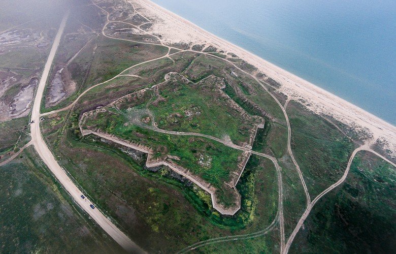
In the 20th century, the Arabat Fortress was remembered once again. The new century brought new wars. Initially, soldiers of the Red and White armies hid here. It all ended with the Perekop-Chonhar Operation and the Sovietization of Crimea.
During World War II, fierce battles raged here. The Germans built an earthen wall, which was later buried. Pillboxes around remind of the distant events of that war. A few decades later, the fort would become the filming location for the movie "Two Comrades Were Serving" featuring Vladimir Vysotsky. But that, perhaps, is all. The fort was forgotten. Local residents gradually dismantled the stones of the grand fortress for cottages by the sea. Excavations are not conducted (even though a temple of Hercules once stood near Arabat).
The complete lack of interest in the fortress is sad, but not surprising. Especially in the context of the events of the last five years, when monuments of architecture and archaeology are being destroyed either due to the indifference of the occupation authorities or because of "reconstruction." It is not even clear which is worse.
Not far from the Arabat Fortress lies the village of Ak-Monai (translated from Turkic languages as "white forehead"). In Soviet times, the village was renamed Kamyanske, as stone extraction was carried out here.
The Ak-Monai quarries are less famous than the Adzhimushkai ones, but World War II did not bypass this multi-level gallery either. For four months, the positions of the Soviet army were located on the Ak-Monai Isthmus, holding the defense from January to May 1942. The famous Soviet poet Konstantin Simonov dedicated the poem "Rains" (Dozhdi) to these events:
Over the Ak-Monai plain A winter rain was falling, and ever stronger, Everything was wet, even the backs Of the horses carrying us dejectedly.
In those turbulent times, the Ak-Monai quarries served as a shelter for personnel.
In the 21st century, the gallery attracted extreme sports enthusiasts, and orienteering competitions were held here. At the end of 2013, searches for World War II graves were conducted in the quarries. Staff of the East Crimean Center for Military-Historical Research descended into the quarries. As a result, the remains of fourteen Soviet soldiers were found.
After the annexation, the "ideologically correct" theme of the "Great Patriotic War" is gaining momentum on the Kerch Peninsula as well. To be fair, search expeditions existed even before 2014. However, they acquired a pronounced character of Soviet-Russian patriotism precisely over the last few years. Here, for example, is a news item from the portal "Kerch – this is my city": "A chapel in memory of wartime heroes was erected near Kerch." The news reports that the event was attended by veterans of the "Great Patriotic War," representatives of search detachments from Crimea, the hero cities of Kerch, Sevastopol, and Moscow, the military-patriotic club "Rodina" (Motherland) of the Tula region, the regiment of the "people's militia" of Crimea, as well as schoolchildren, residents, and guests of the Glazovsky district.
To understand the tone of the event, it is enough to cite the leader of the search expedition: "Memory is our weapon in this war. Obviously, our overseas well-wishers, Western partners, and some neighbors in the Soviet Union are still afraid of our fallen heroes; the enemies of Russia to this day fight against them and try to destroy their memory."
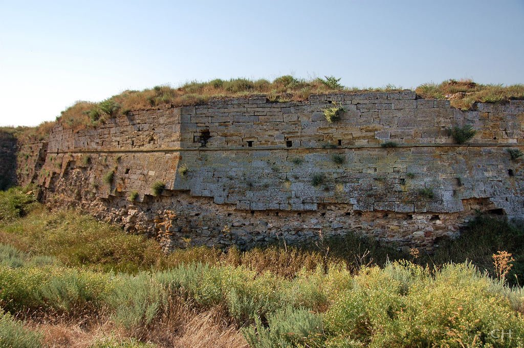
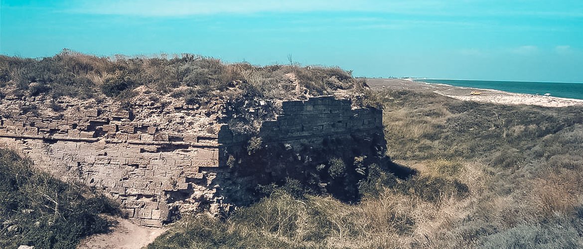
Remains of the Arabat Fortress
This digression regarding the Ak-Monai quarries perfectly illustrates the attitude of the Russian occupation authorities towards the Crimean Peninsula. As that man said: "Memory is our weapon." And he is right. However, if one lives by his logic, not all memory is important.
For some reason, this memory does not extend beyond World War II. Although on the site of the village of Ak-Monai, there was a settlement back in the days of the Bosporan Kingdom. The Arabat Fortress is a monument of architecture. The Arabat Spit has seen many peoples and events. But that is not convenient.
By the way, the Arabat Fortress, by a twist of fate, is performing its function once again: Russian military personnel are now stationed here. I wonder who they are defending themselves against? Are they really waiting for Ukrainian Cossacks?
With the support of the Ukrainian Cultural Foundation