The Mysterious World of "Cave Towns"
One of the most popular monuments of Crimea is the unique "cave towns".
Yevheniia Borysenko. "Krymska Svitlytsia" Newspaper, 2020, Issue No. 2
During the last three years on the pages of our publication, in the local lore section, we together with our readers plunged into fascinating journeys to famous and not-so-famous, and sometimes opened for ourselves completely new corners of our incredibly beautiful peninsula. We have visited mountain plateaus, the seabed, and the wide desert steppe, tasted delicious local wine, got acquainted with interesting informative stories and legends of Crimean cities and towns. However, in addition to the sea, mountains, and steppe, there is another beauty on the peninsula — its so-called "cave towns." So we correct the situation and this year offer our readers a series of interesting journeys through the "cave towns" of Crimea.
Crimea is unique, amazing, and always different. Many roads of Crimea lead from millennium to millennium, for there are towns and corners here, witnesses of ancient times, where everything seems to breathe history. Here you can touch the stones hewn by the legendary Tauri, climb the burial mound of a Scythian ruler, or enter under the vaults of a majestic medieval fortress. Here stone and water speak — and water has turned into the stone of stalactites and stalagmites of hundreds of amazing caves since time immemorial...
Among the most popular monuments of Crimea are the unique "cave towns," visiting which makes you feel as if you have entered the medieval world. Along the Inner Ridge of the Crimean Mountains in the southwest of the peninsula, in hard-to-reach places, a chain of mountain towns, fortresses, monasteries, and fortified settlements stretches. Located in a surprisingly beautiful mountainous area, which in itself is worth visiting, the "cave towns" form a kind of tourist "Golden Ring."
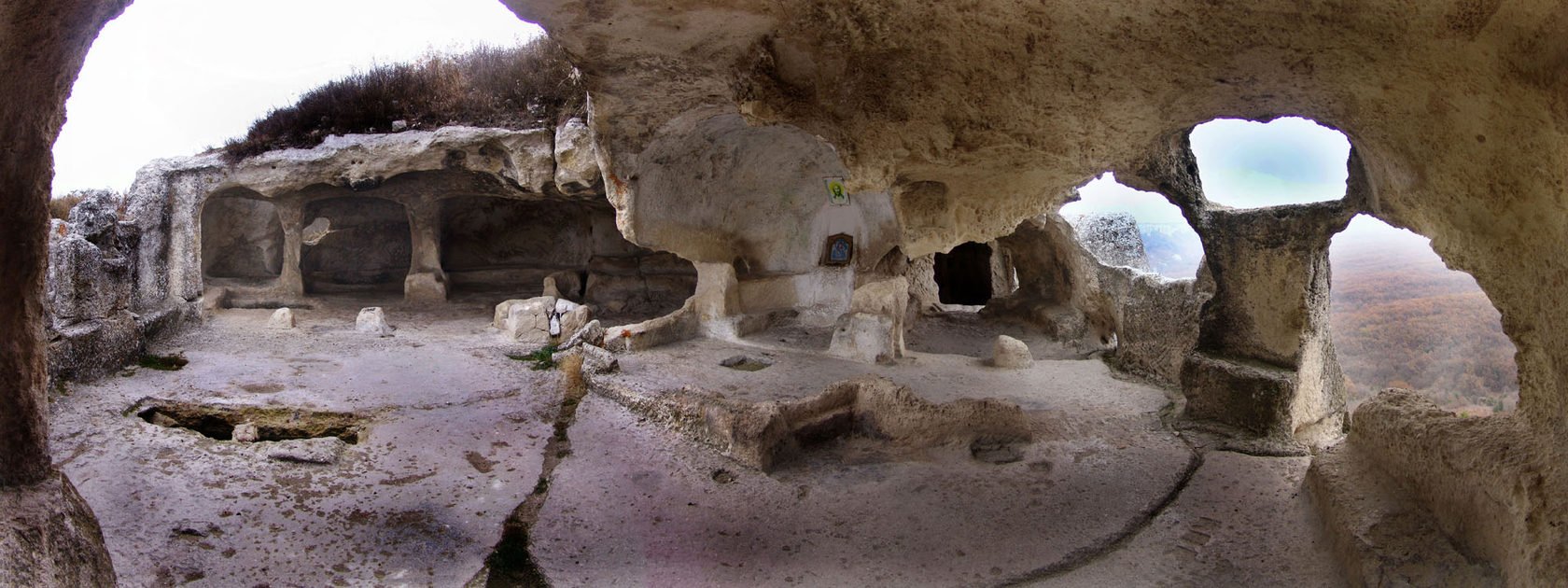
The cave town of Eski-Kermen. Photo by A. Kovalsky
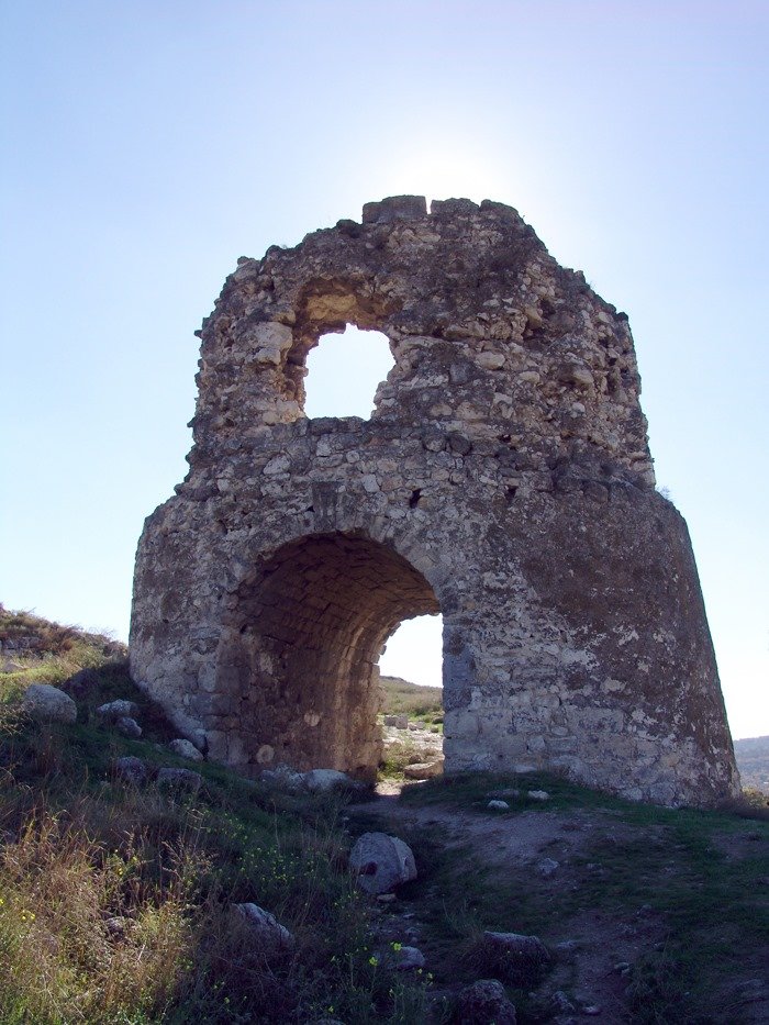
Kalamita Fortress in Inkerman near Sevastopol. Photo by A. Kovalsky
Until recently, "cave towns" were considered homogeneous and simultaneous monuments. This gave rise to a whole range of misunderstandings and deceptive historical conclusions. It should be noted that they are the least studied cultural and archaeological sites in Crimea, and scientific and technical research, the use of geomechanical research methods and modern underground construction, are still waiting for their time.
The first thorough description of the "cave towns" was left in 1578 by Marcin Broniewski, ambassador of the Polish King Stefan Batory to the Tatar khan. Unfortunately, after the Turkish conquest, these towns were destroyed and fell into decay; almost no written evidence about them remained. Detailed information about the "cave towns" is provided only by the 17th-century Turkish traveler Evliya Çelebi. The first scientific research was conducted by Academician P. S. Pallas (1793–1801).
Also of great importance is the six-volume description of Crimea and the Caucasus by the Swiss traveler Dubois de Montpéreux (containing a rich atlas of drawings of "cave towns"). The words of H. V. Kovalevsky can serve as a conclusion of the studies of many scientists on the protective role of the "cave towns": "...in their isolated nests, they preserved ancient and peculiar relics of the past — fragments of human races, languages, old economic forms, customs, way of life, remnants of flora and fauna."
Despite the fact that these cultural monuments of different times are insufficiently studied, they can already be divided into three completely diverse groups.
The first group consists of the remains of fairly large fortified settlements on separate heights or on rocky capes of the Inner Ridge. They were protected by natural obstacles — cliffs and powerful fortress structures. Each of them occupied several dozen hectares. The inner territory of these fortifications was divided, as a rule, into two parts. On one of them was the settlement itself. Even now, significant traces of streets, squares, and residential buildings are clearly visible in places. The other part, lying in the depth, has no traces of dwellings. Here, in a fairly large area, caravans that came under the protection of the fortification could be located, and in wartime, residents of surrounding villages with their herds, supplies, and property found shelter.
In addition to ground buildings, numerous auxiliary cave structures, as well as entire complexes of cult structures — churches, tombs, vaults — were carved into the soft limestone rocks. Now the ground buildings are destroyed and overgrown with forest. The cave structures, especially those located on the cliffs of the rocks, have been preserved. This created the impression that the settlements consisted of caves alone, which prompted travelers of the 18th–19th centuries to call them "cave towns."
Four "cave towns" of the first group are known in southwestern Crimea — all in the Bakhchysarai region: Eski-Kermen near the now disappeared village of Kripke (former Cherkez-Kermen), Mangup near Zalisne (former Yukhary-Karalez), Kyz-Kermen near Kudryne (former Shury), and Chufut-Kale. Almost all of them arose during the early Middle Ages. All of these settlements arose near the main ancient path from Chersonesos to the steppe or roads running through the mountains to the southern coast.
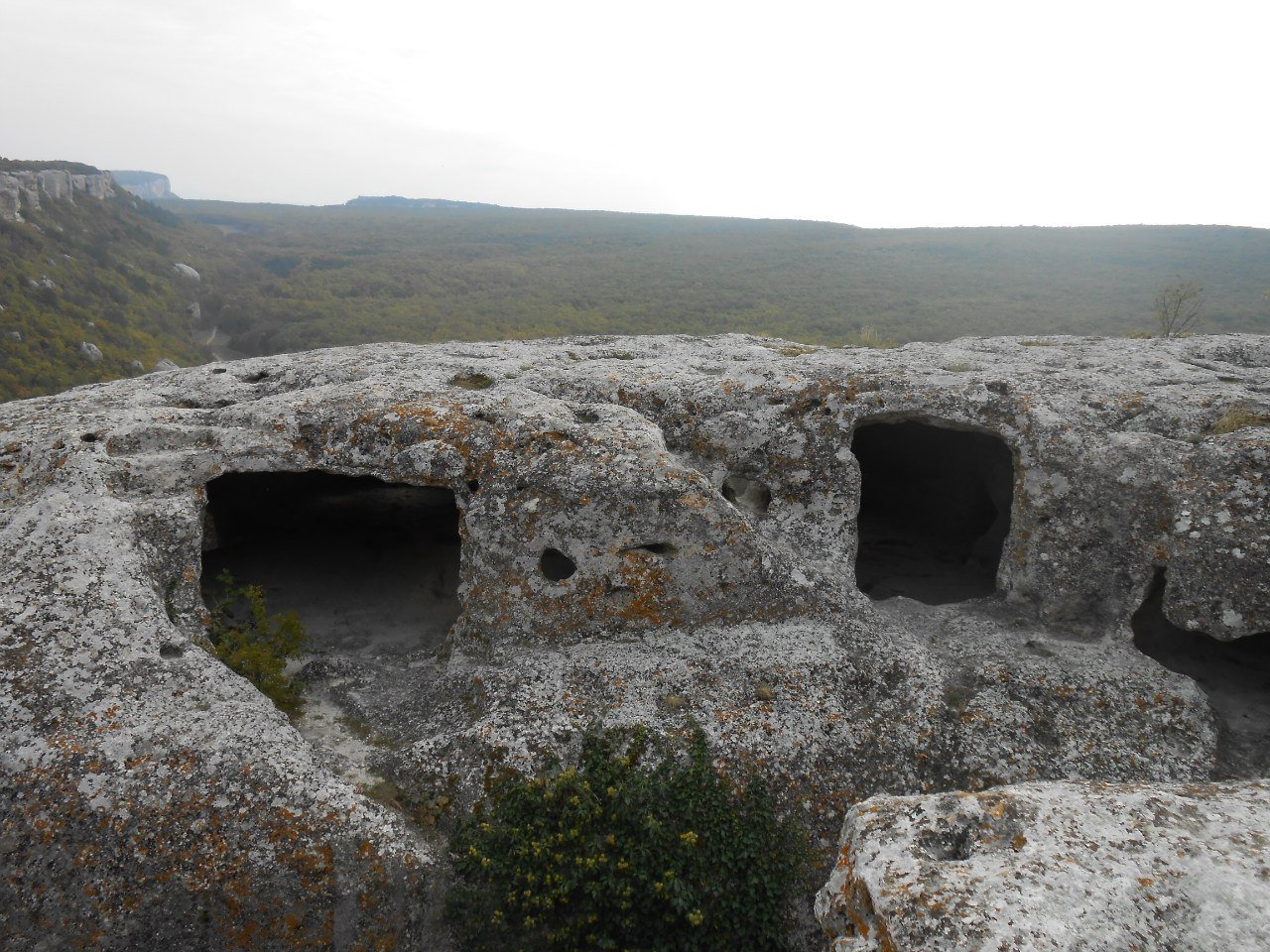
Eski-Kermen. Photo by the author
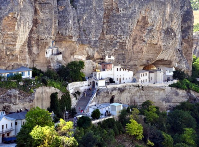
Holy Dormition Male Monastery near Bakhchysarai — Photo from open sources
The second group of "cave towns" consists of small (1.5–2 hectares in area) fortifications located on small heights of the Inner Ridge. Not all of them were located near the main trade routes, but each dominated a valley and controlled the main routes from these valleys to the steppe. For example, on the right bank of the mouth of the Chorna River, dominating the Inkerman Valley, stood the Kalamita Fortress. In the depths of the Belbek Valley rise the ruins of the so-called Suyren Fortification. In the middle course of the Kacha River on Mount Tepe-Kermen are the ruins of the fortress of the same name. On the watershed of the Bodrak and Alma rivers are the remains of a small fortification known as Bakla.
And to the northwest of Eski-Kermen, on the plateau of a neighboring cape, rises a tower with a gate — the remains of Kyz-Kule castle (Maiden's Tower). Thus, each mountain pasture or fairly isolated tract had its own fortification. In these small fortifications, the remains of powerful defensive structures, residential buildings, and small temples were found. There are no trading squares, places for caravan stops, or for sheltering a significant number of people. Most of these fortifications also had artificial caves, which is why they were classified as "cave towns." In reality, they were nothing other than feudal castles.
The third group of "cave towns" includes the remains of later Christian monasteries, consisting mainly of numerous artificial caves, arranged, as a rule, in several tiers on the cliffs of the Inner Ridge. These are Uspensky (Holy Dormition), Inkermansky, Chiltre, Shuldan, Kachi-Kalyon, and others. Along with cave household and cult structures — churches, chapels, tombs, etc. — there were many cells cut into the rocks. Such monasteries are very similar to the cave monasteries of the Caucasus (for example, the Vardzia monastery in Georgia), Asia Minor (Cappadocia), and Sicily.
These monasteries, as a rule, had no special defensive structures, ground or cave. They arose no earlier than the 9th–10th centuries and were located near towns and castles. Some of them, most likely, were their additions, while others existed independently.
The "cave towns" give no reason to see in them a coherent defensive system — the embodiment of some military-strategic design of Byzantium. They arose at different times and independently of the Byzantine Empire, due to the socio-economic and political conditions that existed in southwestern Crimea over a long period of time.