A Mythical Project at the Expense of Ukraine
The construction of the Kakhovka HPP, the South Ukrainian, and the North Crimean canals and how it helped the Crimean Peninsula.
Petro Volvach, full member of the Shevchenko Scientific Society (NTSh), member of the National Writers' Union of Ukraine (NSPU), Honored Worker of Science and Technology of the AR of Crimea, Crimean resident with 60 years of experience. Newspaper "Krymska Svitlytsia", 2018, issue No. 4
The reaction of the Ukrainian leadership to the union Decree "On the construction of the Kakhovka HPP on the Dnieper River, the South Ukrainian and the North Crimean canals" was lightning fast. Already on November 26, 1950, the Decree of the Council of Ministers of the Ukrainian SSR and the Central Committee of the CP(b)U "On conducting primary exploratory and design works for the construction of the Kakhovka HPP, the South Ukrainian and the North Crimean canals" was issued. Thus, it is from this date and the decree of 1950 that the history of the creation of both the Kakhovka Reservoir and the Kakhovka HPP, as well as the intentions to construct the South Ukrainian Canal, should be counted.
As we can see, the idea of constructing the North Crimean Canal occupied a secondary place in this decree, since this facility was located on the territory of another union republic.
The indicated decree convincingly proves that the Ukrainian government over the following years was to focus precisely on the construction of the South Ukrainian Canal. For this purpose, the volumes of priority design and exploratory works were determined for a number of republican construction and design organizations to prepare the future site both for the construction of the Kakhovka HPP and the Kakhovka Reservoir, and the route of the future South Ukrainian Canal. Attention is also drawn to the circumstance that, besides the volumes of design and construction works on the territory of Ukraine, Ukrainian organizations and specialists were also obliged to conduct hydrological surveys and compile maps of hydrogeological irrigation and watering zones not only of the southern regions of the state, but also of the northern regions of Crimea.
The indicated decree set the task during 1951-1952 to introduce stationary observations and study of the groundwater regime and its chemical composition on the Kakhovka massif of the Kherson region, on an area of 8 thousand km2 at 80 points, and in the irrigation system zone of the North Crimean Canal on an area of 5 thousand km2 at 30 points.
Not only the Ukrainian Academy of Sciences but also all profile research institutions of the republic were involved in conducting soil research and soil mapping in the southern regions of Ukraine and Crimea. The research was conducted on an area of about 50 thousand hectares. The Main Directorate of Vocational, Railway, and Construction Organizations was tasked with starting the training of specialists in blue-collar occupations.
The government obliged the Main Directorate of Construction "Ukrvodbud" to organize during 1951 in Zaporizhzhia, Kherson, and Melitopol three educational and production complexes for training excavator operators, master hydromechanizers, topographers, and other workers' professions. In addition, in several regions of the south of Ukraine (Zaporizhzhia, Kherson, Mykolaiv, and Dnipropetrovsk), the employees of the "Ukrvodbud" system involved in this construction, who lived in the construction zone of irrigation facilities, were exempted from compulsory agricultural taxes.
The Ministry of Health of the Ukrainian SSR during 1951-1952 was to establish "hospitals, kindergartens, pharmacies, and medical centers" in the construction zone. In the construction zone, on the rivers Dnieper, Molochna, Konka, and along the route of the South Ukrainian Canal, the Ukrainian Institute of Communal Hygiene by September 1951 was to conduct, through the sanitary and epidemiological service, a survey of settlements in flooded areas and in the sanitary protection zones of the reservoirs of the South Ukrainian Canal.
The same ministry, together with the executive committees of the southern regions of Ukraine (Zaporizhzhia, Mykolaiv, and Kherson regions), within a month was to submit proposals to the government regarding the expansion and construction of water supply networks, sewerage, and the entire social infrastructure (baths, laundry complexes, municipal transport, power plants, bridges, utility enterprises), as well as the construction of residential houses, hotels, towns, and settlements along the entire route of the South Ukrainian Canal.
Undoubtedly, the construction of both the South Ukrainian Canal itself and its powerful infrastructure, declared and inflated by the communist propaganda machine, was never implemented. It remained only at the level of another project. However, this clamor distracted the attention of the scientific community and local residents from discussing and criticizing the decision, dangerous and harmful to people and the environment, to create an artificial sea on the most fertile lands and the richest, historically and archaeologically priceless Dnieper floodplains. According to specialists' estimates, because of the construction of the Kakhovka Reservoir alone, Ukraine lost tens of thousands of its most productive agricultural lands and almost all of the unique Dnieper water meadows, floodplains, lakes, and large areas of forests.
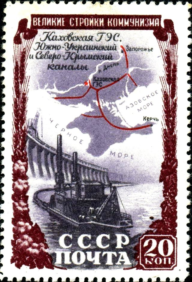
The advertised idea of constructing the South Ukrainian Canal and reservoirs on the Molochna and Konka rivers simultaneously with the Kakhovka Reservoir was never realized. The country never saw a single meter of the mythical South Ukrainian Canal. And the promised water regulation of the flows of the steppe rivers Molochna and Konka was never implemented. They still remain shallow and overgrown with reeds.
Note that on the construction of the Kakhovka HPP and the city of Nova Kakhovka alone, more than 12,000 specialists, 1,110 vehicles, 74 dredgers, 14 steam locomotives, 100 bulldozers, and 75 crawler and port cranes were working. Even more people and technical means were involved in the construction of the Kakhovka Reservoir. Its flooding was completed in 1954, and the Kakhovka HPP began operating in 1955. In 1956, the sixth unit of this station was commissioned.
Only in 1976 was the Kakhovka Irrigation Canal opened, which ensured the supply of water to the Kakhovka, Priazovske, Sirohozy, and Chaplynka irrigation systems and solved the water supply problem of the city of Berdiansk. In 1985, 195 thousand hectares of agricultural land were irrigated in the zone of the Kakhovka Canal. The construction of the Kakhovka Reservoir and the Kakhovka HPP, according to statistical data, provided irrigation for 15.2% of land holdings in Crimea, 8.5% in Kherson, and 8.3% in Zaporizhzhia regions.
Starting from September 1950, that is, from the moment of the issuance of the union decree "On the construction of the Kakhovka HPP, the South Ukrainian and the North Crimean canals", the government of the RSFSR did not conduct any construction or design-exploratory works on the territory of the Crimean region. The question of building the North Crimean Canal reappeared on the agenda shortly after the transfer of the Crimean region from the RSFSR to the Ukrainian SSR.
On March 15, 1954, the Council of Ministers of the Ukrainian SSR and the Central Committee of the CPU adopted a decree "On the construction of the North Crimean Canal". One can only guess why this problem did not arise during the time when Crimea was part of the Russian Federation. By Russia, this highly complex and expensive construction was deliberately delayed in order to shift this facility onto the shoulders of Ukraine at a convenient moment.